

Truskmore [Trosc Mor]
Good walks are even better shared.
G7647 : Plateau edge, Truskmore
Richard Webb Photo source
Overview
Truskmore [Trosc Mor]
Truskmore, towering at 654 meters, is not just another peak in the Sligo Mountains, it's the cherry on top of a stunning landscape! If you're looking for a hike that promises breathtaking views and a hefty dose of Irish charm, look no further.
Geology
This fascinating mountain is made up of limestone dating back to the Carboniferous period, showcasing a plethora of karst features. The rock formations tell stories of geological transformations, so if you fancy yourself an armchair geologist, or just enjoy pondering how rocks came to be, Truskmore has a lot to offer!
Accessibility
Getting to Truskmore is a piece of cake. There is a dedicated parking area at G757981, capable of providing space for a fair number of vehicles. However, it fills up faster than you can say ‘What’s the weather like up there?’, particularly on weekends. For those relying on public transport, there are buses from Sligo town to Calry, where taxi services can whisk you away to the start of your adventure.
Route Information
The Truskmore Loop is the most popular route, covering about 9 km and typically taking around 3.5 hours to complete. It’s rated as a moderate hike, so pack your sandwiches and a sense of adventure!
Terrain
Expect a delightful mix of grassy slopes and rocky outcrops, dotted with a few boggy patches. If the rain has made its rounds, you might find some slippery spots, so tread carefully and maybe leave the heels at home!
Summit Features
Once you reach the summit, celebrate your achievement! You'll be greeted by a sturdy trig point, a stone cairn, and awe-inspiring panoramas. The views from the top are nothing short of spectacular, with sights stretching over Lough Gill and the Atlantic, plus a cheeky peak at the Donegal Mountains on a clear day.
Best Seasons for Hiking
Truskmore shines brightest late spring and early autumn. During these times, the vistas are vibrant and the weather behaves itself, making your hike all the more enjoyable.
Nearby Attractions
If you're feeling adventurous, you might want to take on nearby peaks like Knocknarea or Benbulben. They’re friendly neighbours who also have stories to tell.
Final Thoughts
In a nutshell, Truskmore offers a perfect mix of natural beauty, cultural significance, and a chance to stretch your legs in the great outdoors. Just don’t forget your waterproof jacket – you know how Irish weather can be!
Explore routes near Truskmore [Trosc Mor]
Walks starting near this hill. Open a route to check its map, distance and full itinerary.
Route planning notes
These notes describe possible approaches. Check a route's map and access information when planning your walk.
Truskmore Loop
A scenic loop starting from the Truskmore Mountain car park, offering panoramic views.
Make a day of it, together
Find someone to share the walk with, or organise a day out along a route you like.
Photo Gallery
View all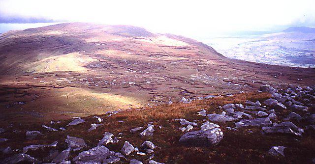 Photo could not load
G7647 : Plateau edge, Truskmore
Richard Webb
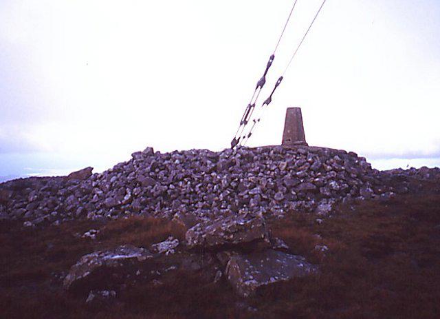 Photo could not load
G7547 : Summit: Trosc Mòr /Truskmore
Richard Webb
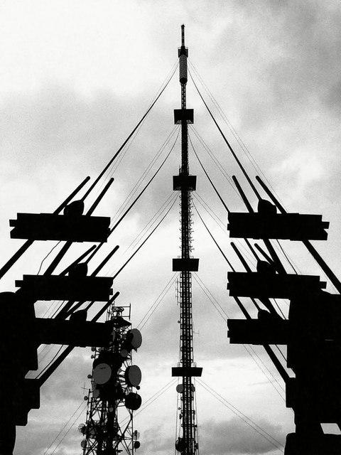 Photo could not load
G7547 : The communications towers at the summit of Truskmore, Co. Sligo
Enda O Flaherty
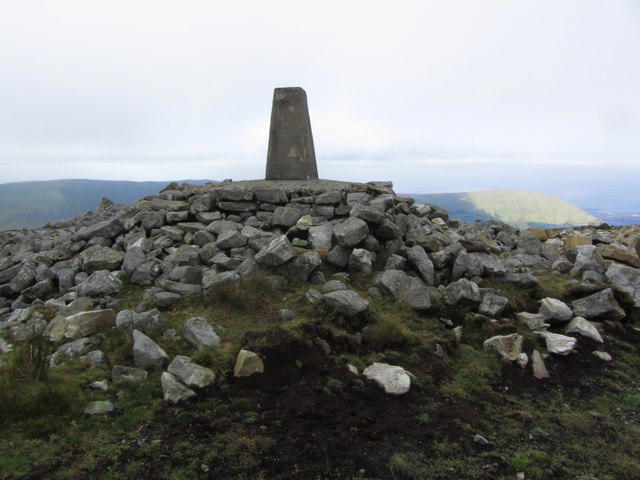 Photo could not load
G7547 : Trig point on Truskmore, Dartry Mountains
Colin Park
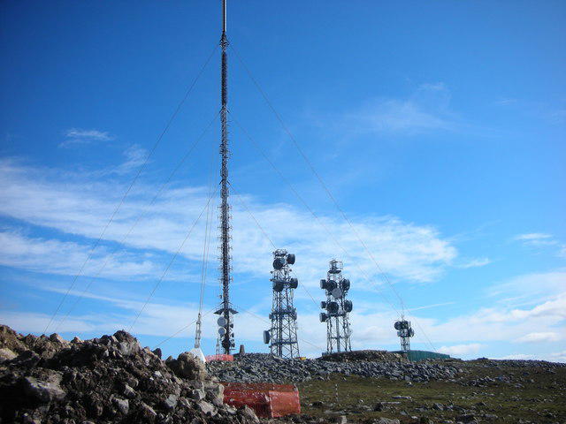 Photo could not load
G7547 : Sligo. Truskmore Summit. 2122 feet
Michael Murtagh
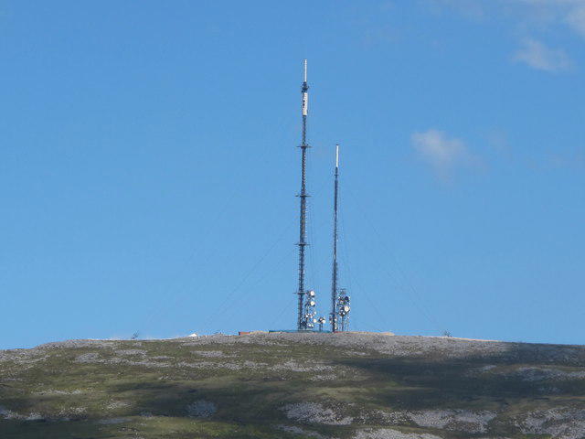 Photo could not load
G7547 : Sligo: View Of Truskmore Mountain RTE Communication Mast
Michael Murtagh
Hill facts and local notes
Classifications
Elevation
647m
2,123 ft
Prominence
560m
Coordinates
54.3742, -8.3716
G759473
OS Map
16
At the Summit
The summit features a well-constructed trig point, a stone cairn, and sweeping views of the surrounding countryside.
Terrain & Geology
Primarily comprised of limestone with some interesting dolomite outcrops. The age of the rock aligns with the Carboniferous period, and the area is peppered with karst features that showcase erosion's artistry.
Views & Scenery
From the summit, you can see Lough Gill, the Atlantic Ocean, and on a clear day, the distant peaks of the Donegal Mountains.
History & Heritage
Name Origin
The name 'Trosc Mor' translates to 'Big Sump' in Irish, possibly referring to the mountain's shape or the surrounding landscape.
Historical Significance
Truskmore is significant in local folklore and is often associated with legends of ancient tribes that roamed these hills.
Getting There & Facilities
Parking
There is a designated parking area at G757981; it can accommodate several vehicles but fills up quickly on weekends.
Public Transport
Buses from Sligo town run regularly to the nearby village of Calry, where you can find taxi services to the trailhead.
Nearby Facilities
Facilities are limited near the mountain, but nearby Sligo has cafes, toilets, and other essential services.
Safety Information
Known Hazards
- Beware of sudden weather changes; the mountain can quickly transform from sunny to blustery. Wet patches can be slippery, especially in steeper areas.
General Safety Tips
- Check weather conditions before setting out
- Carry appropriate clothing and equipment
- Let someone know your planned route
- Take a map, compass, and GPS device
- Carry emergency supplies: food, water, first aid kit, torch
Hills
Some common questions about the hills answered
Are there group walks up Truskmore [Trosc Mor]?
Many walkers use Walkmates to join or organise walks with others. You can check for group walks around Truskmore [Trosc Mor] through the maps
Are there other walkers around Truskmore [Trosc Mor]?
Activity varies by location and time, but Walkmates lets you see whether others have shared walks or shown interest in this area. Find other people through the walking friends search walking friends for Truskmore [Trosc Mor] search or of course create your own walk for Truskmore [Trosc Mor]
Can I organise a walk to Truskmore [Trosc Mor]?
Yes. If there aren’t any walks listed already, you can create a walk and make it available for others to join.
If you're signed up to Walkmates, you can create a walk to Truskmore [Trosc Mor].
How do I find a walk up this hill?
There are often multiple ways to walk this hill, depending on experience and route preference. Walkmates helps you explore walks and routes that others have shared.
Can I suggest a new route up Truskmore [Trosc Mor]?
Yes. You can suggest or create routes to share with others. Walkmates focuses on the social side of walking, so routes are used to help people organise walks and explore areas together, rather than as detailed navigation tools or route libraries.
Other uses really appreciate knowledgeable walkers sharing their routes. Share your favourite route to Truskmore [Trosc Mor] here
The is an error or something incorrect about this hill. How do I let you know?
We always strive to keep the information on Walkmates as accurate as possible. If you find an error, please let us know through the contact form and we'll aim to correct it as quickly as possible
Community Discussion
Comments
Location
![Truskmore [Trosc Mor] location map](https://cdn.walkmates.com/hill-maps/hill-sources/20168/54.37415_-8.37161.png)
Grid reference: G759473
View on OpenStreetMapOpens a map in a new tab, centred on the hill.
No comments yet. Be the first.